GR-341 Stage 1

 Back
Back 

Route data
Alcalá la Real
Priego de Córdoba Ctra Algarinejo Loja A4154

Distance
31 Km

Duration
7h
Lineal route

Difficulty
Expert

Max. elevation
787 m.

Max. elevation
1027 m.
Weather forecast
Almedinilla
 24°C
24°CReal feel 24°
broken clouds
-
Mon
5/10
26° /21°
 31%
31%
-
Tue
6/1023° /20°
60%
-
Wed
7/1022° /17°
53%
The trail starts in Alcalá la Real on Camino Nuevo; from there, the route heads towards the hamlet of Puertollano along the path known as Camino de la Cruz de la Mata, following the old route of the Córdoba–Guadix trail
ITINERARY DESCRIPTION
The trail starts in Alcalá la Real on the Camino Nuevo; from here, the route heads towards the hamlet of Puertollano along the path known as the Camino de la Cruz de la Mata, following the old route of the Córdoba–Guadix trail. On reaching Puertollano, extreme caution is required on a short stretch that runs along the JV-2238 road and coincides with the Alcaudete–Granada route.
Once in Puertollano, we cross the Córdoba–Granada road (N-432) via an overpass and, immediately afterwards, head towards the Cruz de la Jurada on a steady, pleasant climb through olive groves, following an old path which, in its final section, is cobbled. Once at the Cruz de la Jurada, we can enjoy unbeatable views over Alcalá la Real and the Castillo de la Mota, whose silhouette is outlined against the horizon with the Sierra Nevada as a backdrop.
From the Cruz de la Jurada, we descend a long stretch along a tarmac track to the ravine known as Barranco de la Muriana, and from there we take a dirt track that leads us to the outskirts of Fuente Álamo, skirting the foothills of Cerro de las Albarizas.
After passing through Fuente Álamo, we will head towards the hamlet of Sileras, now within the municipality of Almedinilla, on a stretch where we will join the Divisoria track and later the Camino de las Chozas path, via which we will reach this hamlet.
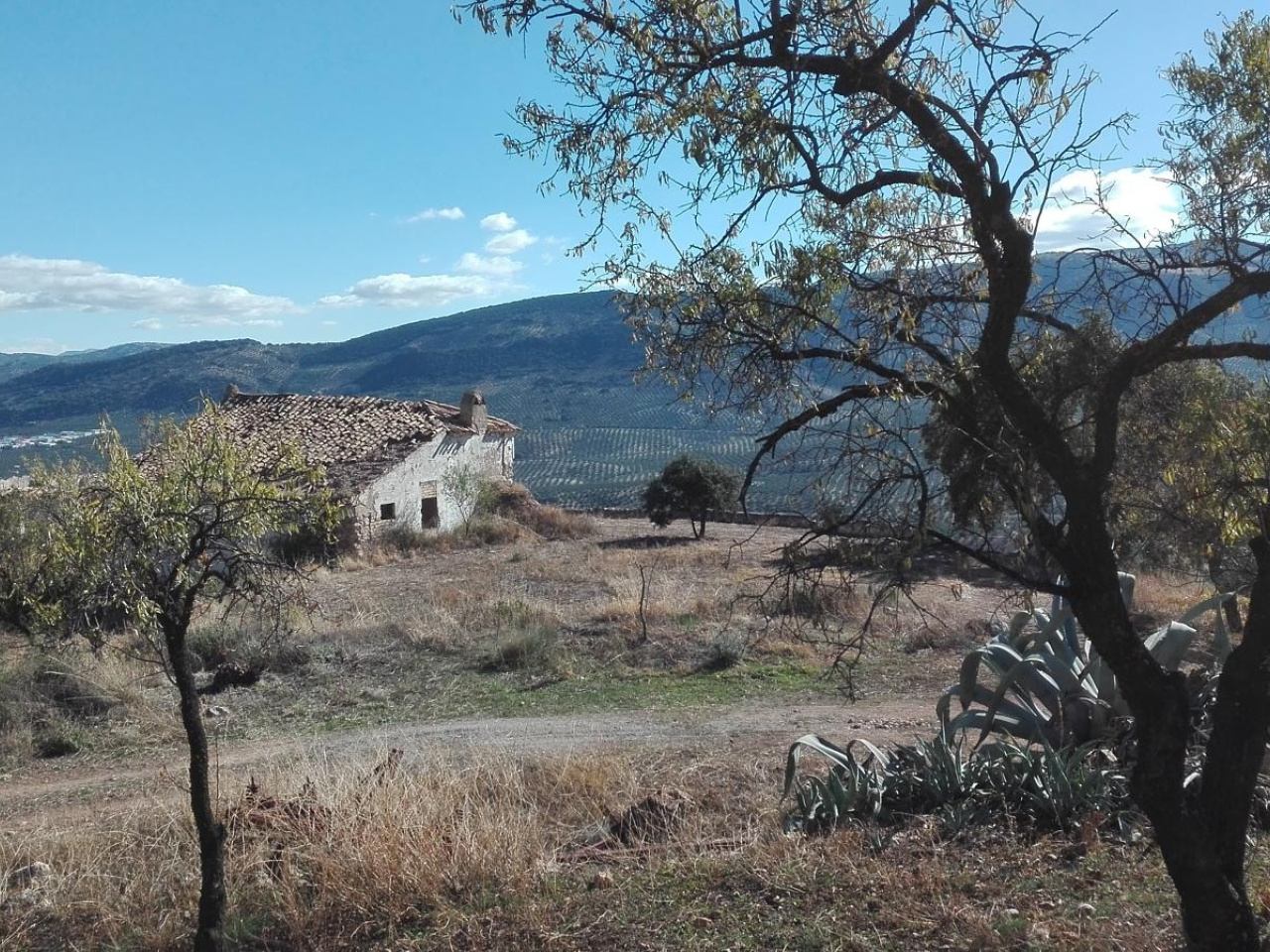
Once in Sileras, we will take a tarmac track towards La Carrasca, following the route of the Camino de la Renta path, also known as the Camino de los Ríos. From La Carrasca, our route will run along a dirt track parallel to the River Almedinilla, which we will eventually cross in a spot of great beauty where the poplars form a lovely gallery forest.
From the River Almedinilla, we will enter the municipality of Priego de Córdoba and climb up to the hamlet of El Poleo, whose pretty cluster of houses and winding alleyways will lead us onto an old, little-used track—which has, in places, become a footpath—that will take us to the hamlet of Concepción. On this stretch, we can enjoy magnificent views over the town centre of Priego de Córdoba, with La Tiñosa in the background – the highest point in the province of Córdoba (1,570 m).
From Concepción, we will descend to Priego de Córdoba along the Concepción path until we reach the Priego–Alcalá la Real road (A-339), which we will cross at the junction with the Priego–Almedinilla path at the spot known as Puerta de Granada. To reach the town centre of Priego, we will take a path that climbs up near the Balcón del Adarve until we reach Calle Velero on the Paseo de Colombia, an unbeatable finish with views and surroundings that do justice to the beauty of this town.
DESCRIPTION OF THE NATURAL ENVIRONMENT
The olive grove in Andalusia can be understood, rather than as an agricultural environment hostile to other forms of life, as a semi-natural environment with a necessary and close relationship with both the flora and fauna that surround it. In this sense, for nature lovers, it can indeed be admired for what it is: the world’s largest artificial forest.
Thus, for the proper enjoyment and observation of this environment, there is no better location than this one: the confluence of the two provinces with the highest density of this species on the entire planet, Córdoba and Jaén. These undulating lands sometimes feature steep slopes from which we can delight in the harmonious monotony of the landscape, masterfully broken up by castles, such as La Mota, or by whitewashed buildings that serve as a respite, not only for the eye, but also for the labourers who work here.
Along the way, we will come across fountains channelling springs, such as those at Fuente Álamo or Sileras, which have led to the formation of small settlements around them and which speak of the carbonate nature of the rocks beneath our feet, beyond the clays and marls visible to the naked eye.
Of all the natural environments associated with water, the River Almadinilla, also known as the Caicena, is undoubtedly the most notable. An interesting avenue of trees runs alongside it; at certain points along its course, riverine groves and gallery forests still form. Furthermore, we see here terrain with significant gypsum outcrops, evidence of the presence of some of the oldest materials in the Subbético range.
The final stretch of the route, from the hamlet of Poleo onwards, awakens all our senses to the Sierras Subbéticas Natural Park. The view sweeps across the horizon as far as La Tiñosa, the highest point in the province of Córdoba; the ear begins to recognise more frequently the trills of warblers and greenfinches; the sense of smell savours the fragrance of the gayumba; our taste buds are delighted by wild blackberries, and even our sense of touch clearly identifies the rough texture of the limestone rocks found in the Sierra de los Judíos or forming the travertine of the Balcón del Adarve, our final destination.
PLEASE NOTE. HIGHLIGHTS
The section between the hamlets of El Poleo and La Concepción, within the municipality of Priego de Córdoba, combines the charm of a little-used traditional path along the foothills of the Sierra de los Judíos with the vegetation of the Mediterranean scrubland and the magnificent views that can be seen from here. However, of all these, the most spectacular and surprising is the sudden appearance, as we continue our walk, of the town centre of Priego, overlooking the Balcón del Adarve with the Macizo de la Horconera behind it.
CAUTION.
On this stage, the main danger for walkers is walking along tarmac roads, where our route coincides with motor traffic. In such cases, it is always recommended to walk on the left-hand side of the road, wearing light-coloured clothing, using some form of reflective or luminous material, and avoiding these sections from dusk until dawn. On the other hand, part of the Sierra de los Judíos path is lost. As it is only a short distance, simply follow the edge of the mountain range until you rejoin the path.
BASIC INFORMATION ON ALCALÁ LA REAL
Location of the municipality: Alcalá la Real is the main town of the Sierra Sur de Jaén region, situated in the south-western corner of the province, bordering the municipalities of Almedinilla and Priego de Córdoba, in Córdoba; Íllora, Moclín, Montefrío and Montillana, in Granada; and Alcaudete, Castillo de Locubín, Frailes and Vadepeñas de Jaén, in the province of Jaén itself.
Average altitude of the main town centre: 930 m (above sea level)
Town hall coordinates: 37.459525, -3.924561
Total area: 261.2 km²
Number of settlements comprising the municipality: 22
Population in 2016: 21,758
Climate data: We have a Mediterranean continental climate with an average annual temperature of between 13 and 15°C and average annual rainfall varying between 600 and 800 mm.
BASIC INFORMATION ON PRIEGO DE CÓRDOBA
Location of the municipality: Priego de Córdoba belongs to the Subbética Cordobesa region, and part of its municipal area lies within the Sierras Subbéticas Cordobesas Natural Park. It borders the municipalities of Almedinilla, Carcabuey, Fuente Tójar, Iznájar, Luque and Rute, within the province of Córdoba itself, as well as Algarinejo and Montefrío in Granada and Alcalá la Real and Alcaudete in Jaén.
Average altitude of the main town centre: 645 m (above sea level)
Town hall coordinates: 37.438866, -4.202767
Total area: 288.1 km²
Number of settlements comprising the municipality: 14
Population in 2016: 22,855
Climate data: We have a Mediterranean continental climate with an average annual temperature of around 15°C and average annual rainfall varying between 600 and 900 mm, recorded around Pico Tiñosa.
Weather forecast
Almedinilla
24°CReal feel 24°C
broken clouds
-
Mon
5/1026° /21°
31%
-
Tue
6/1023° /20°
60%
-
Wed
7/1022° /17°
53%